Evolution of the Manchester Metrolink
Manchester Victoria station to Bury opened (converted railway line).
Manchester Victoria to G-Mex (running on the streets through Manchester city centre).
G-Mex to Altrincham (converted MSJ&AR railway line).
Spur to Manchester Piccadilly station opened (street-running)
High Street and Market Street one-directional stops closed. New two-directional stop opened at Market Street.
New branch opened up to Broadway. Cornbrook opened as interchange between Altrincham and Eccles lines.
Broadway branch extended to Eccles.
Shudehill opened to serve a future bus station which would open in 2006.
MediaCityUK tram stop and spur opened off the Eccles Line. G-Mex renamed to Deansgate-Castlefield.
Abraham Moss opened on the Bury Line.
Branch from Trafford Bar to St Werburgh’s Road opened.
Branch from Irk Valley Junction (near Victoria) to Oldham Mumps temporary stop opened.
Oldham Mumps temporary stop to Shaw and Crompton opened.
Manchester Piccadilly station to Droylsden opened.
Shaw and Crompton branch extended to Rochdale Railway Station.
Mosley Street, causing delays in the city centre, closes.
St Werburgh’s Road to East Didsbury opened.
Droylsden branch extended to current terminus at Ashton-under-Lyne.
Woodlands Road, 250 metres away from Abraham Moss, closes. Queens Road opens a little further south on the Bury Line.
Oldham Mumps temporary stop closed on 17 January. New street-running section through Oldham town centre opened.
New street-running section opened from Rochdale Railway Station to Rochdale Town Centre.
Airport Line, the final Phase 3 extension: St Werburgh’s Road to Manchester Airport via Wythenshawe opened.
Extension from Victoria to Exchange Square opened.
Exchange Square to St Peter’s Square opened, completing Second City Crossing (2CC).
Trafford Park Line opened from Pomona to intu Trafford Centre.
Over the weekend, intu Trafford Centre renamed to The Trafford Centre.
Barton Dock Road renamed to Trafford Palazzo.
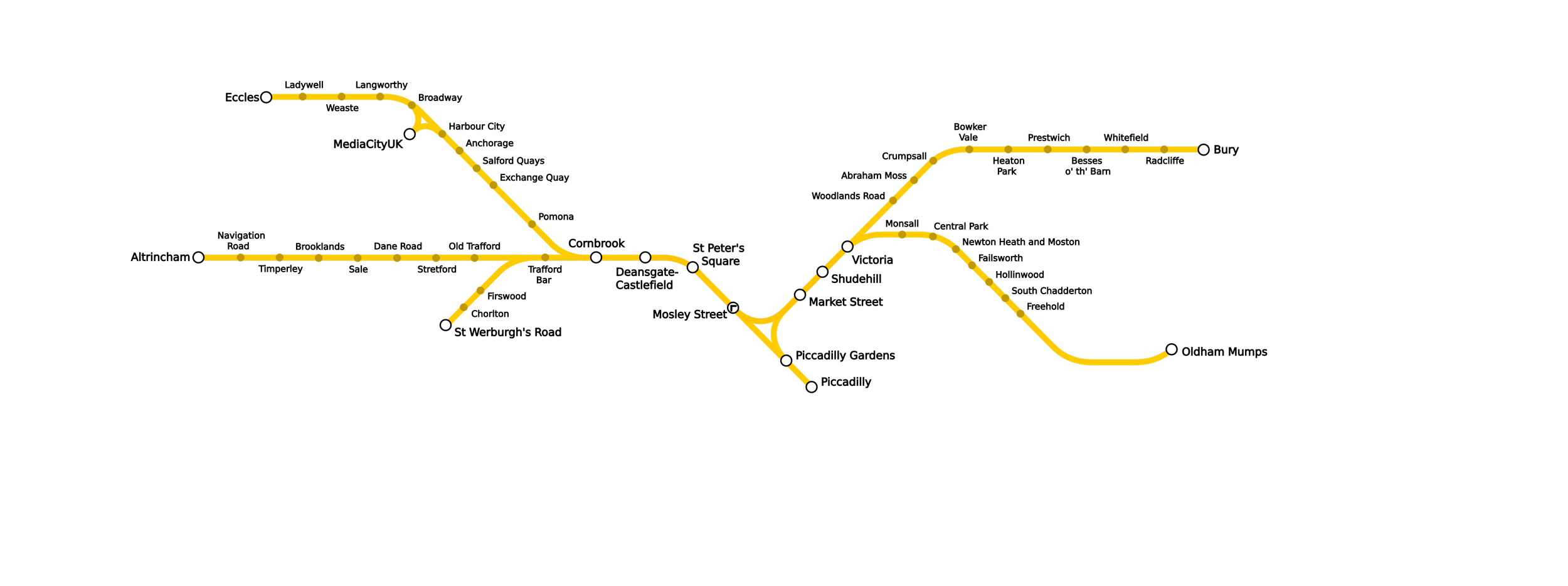
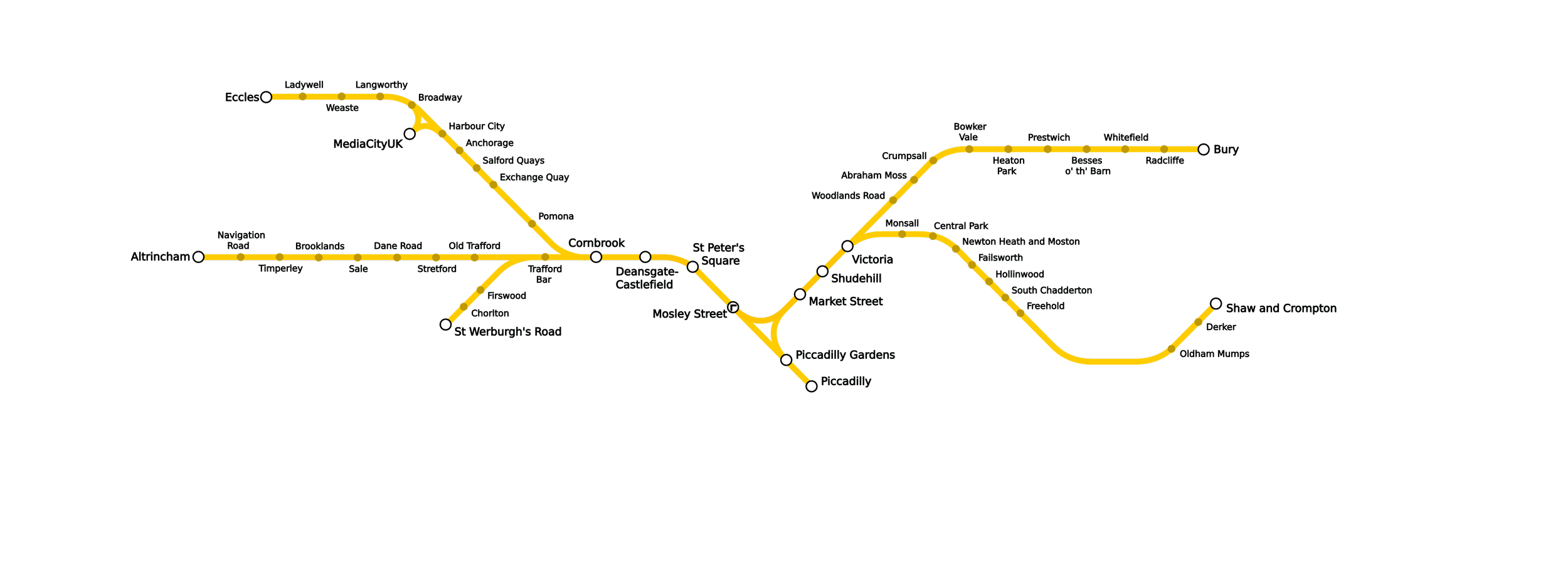
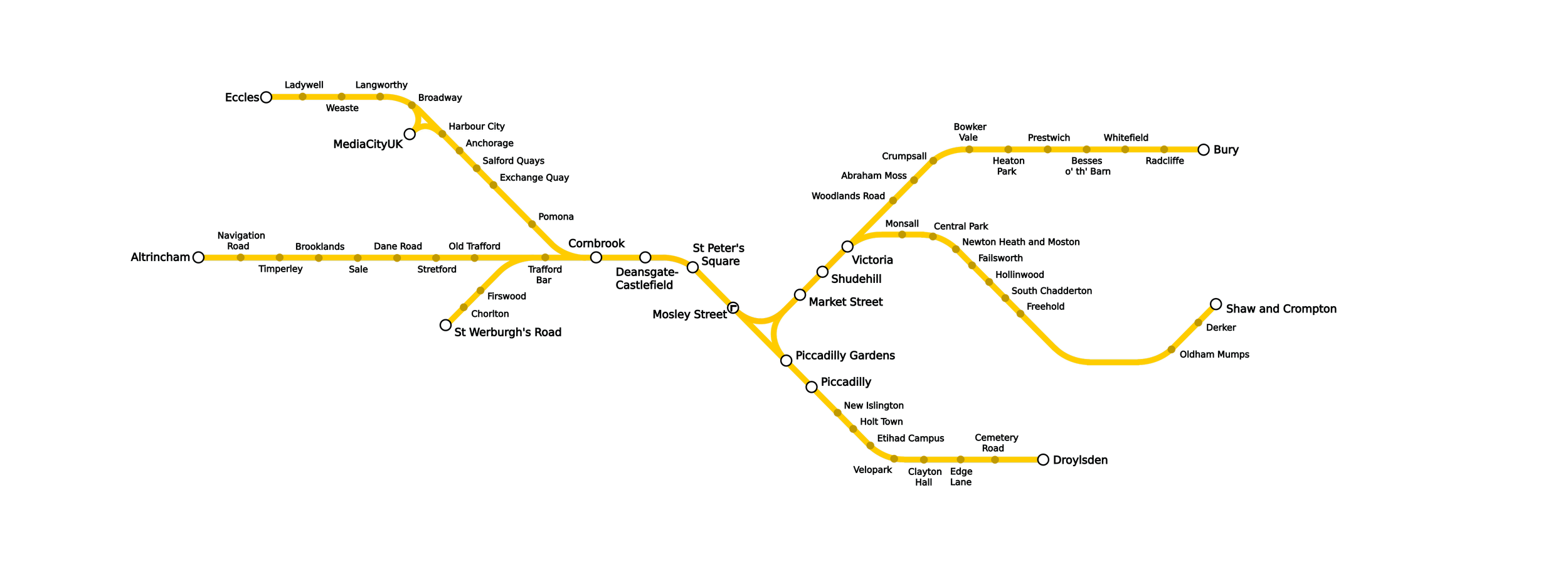
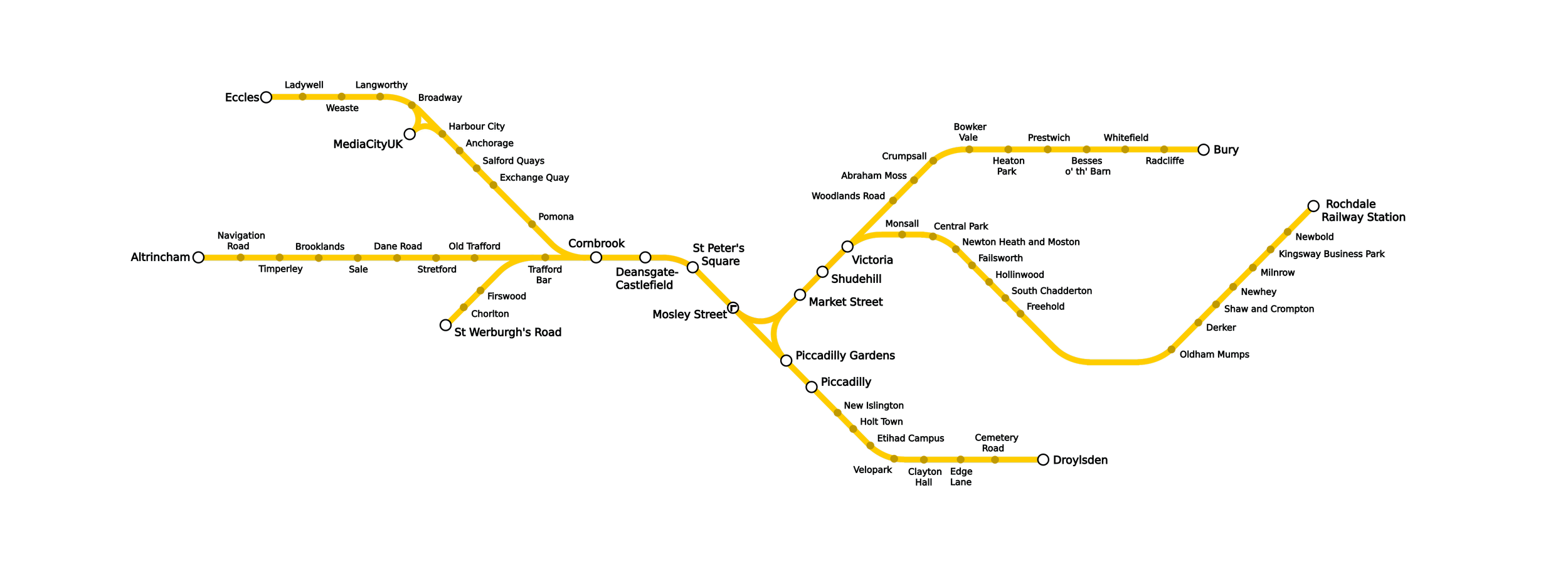
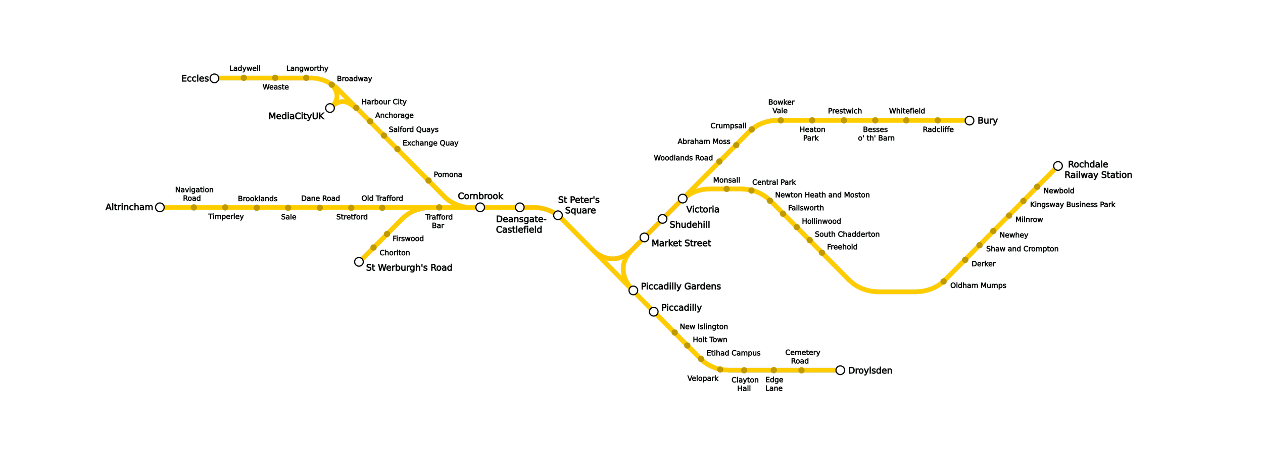
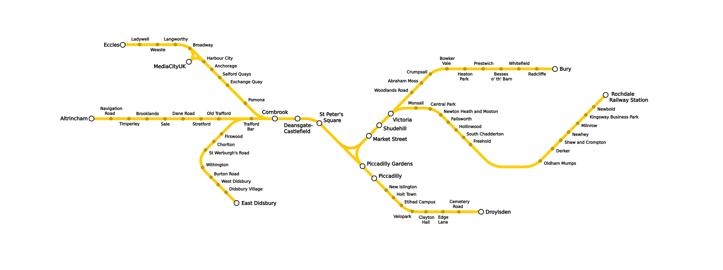
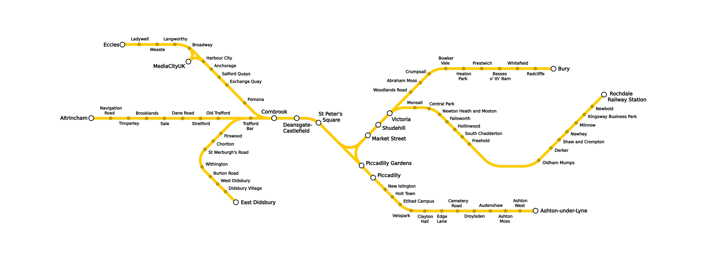
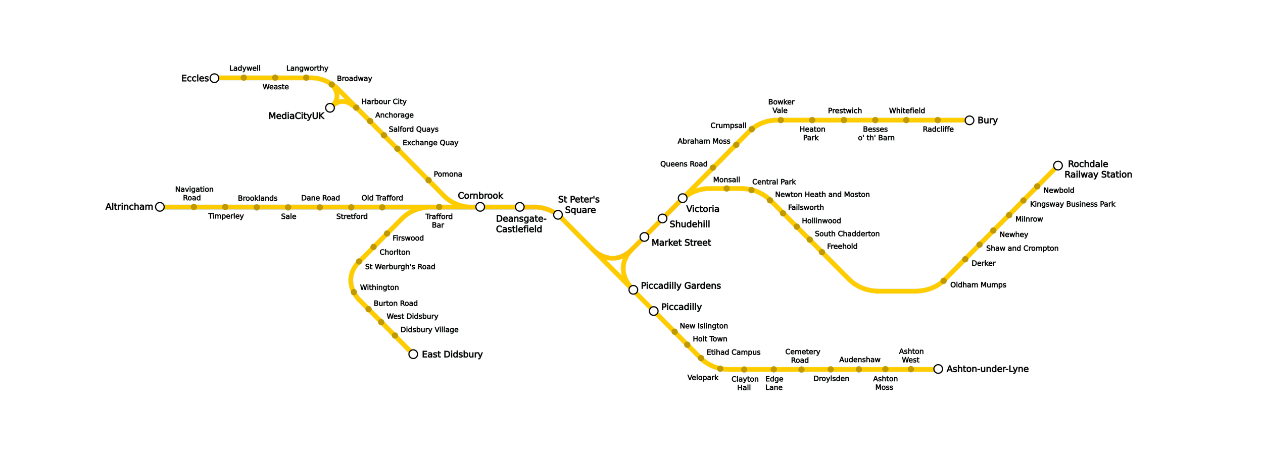
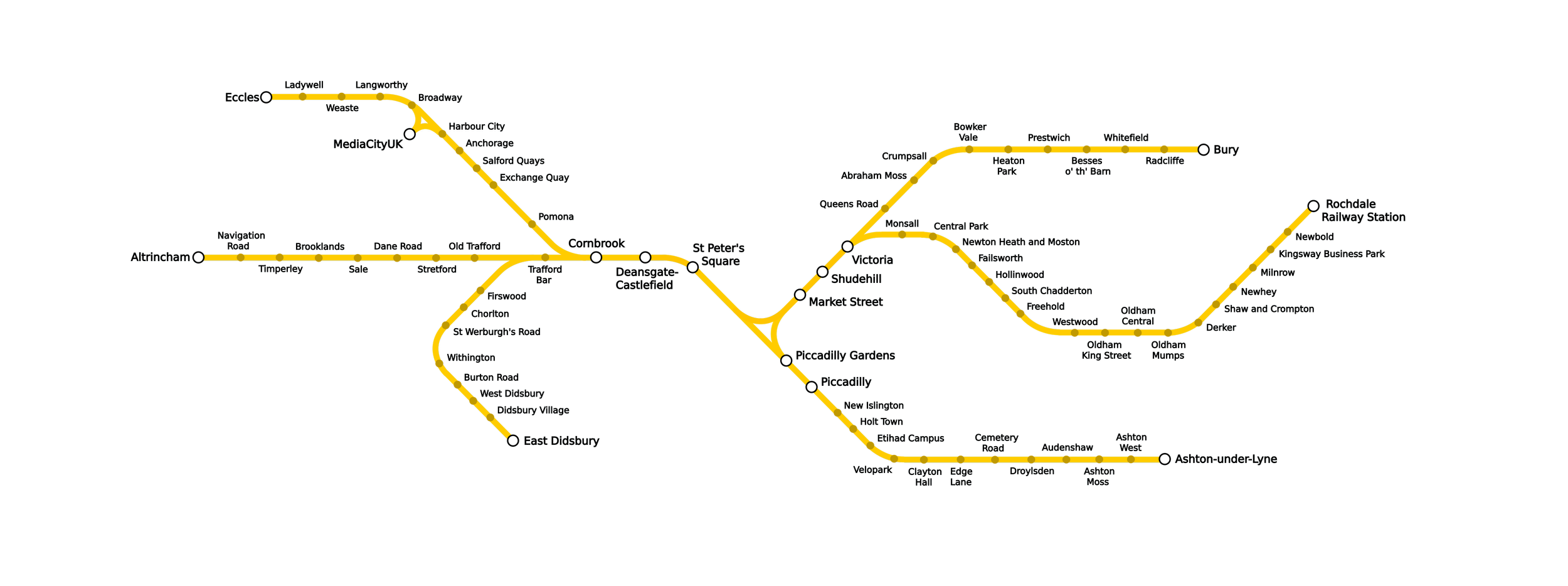
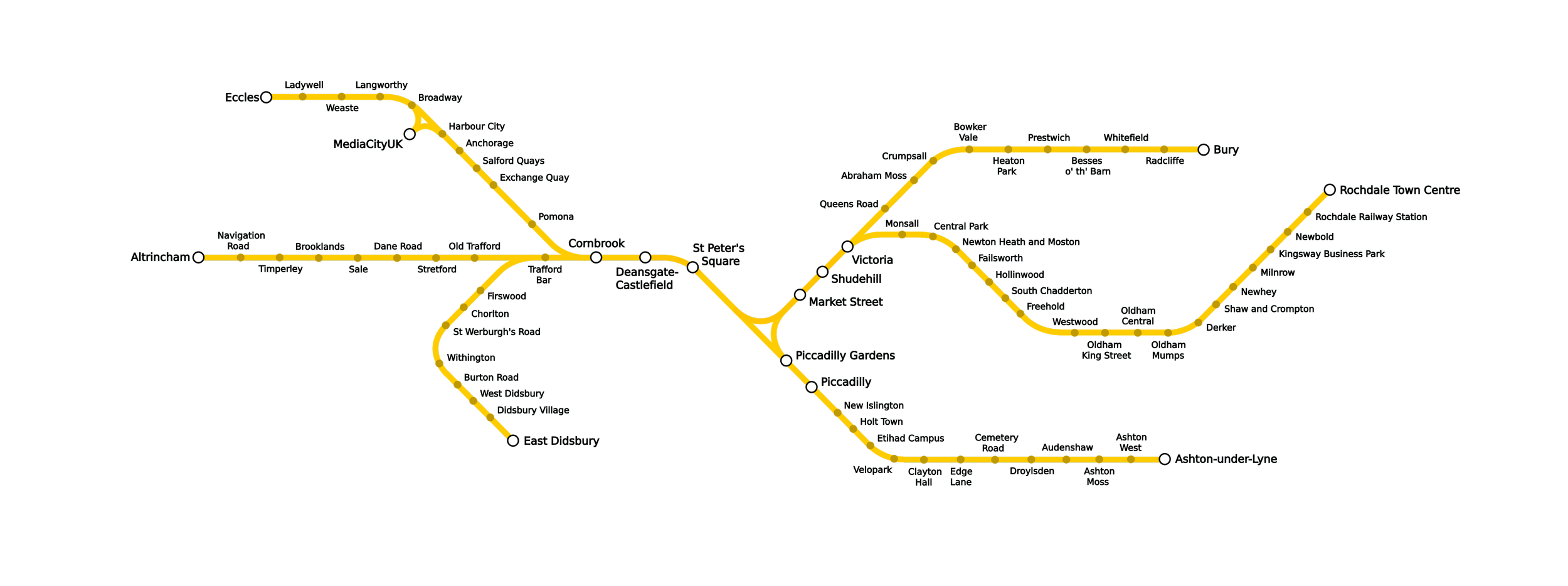
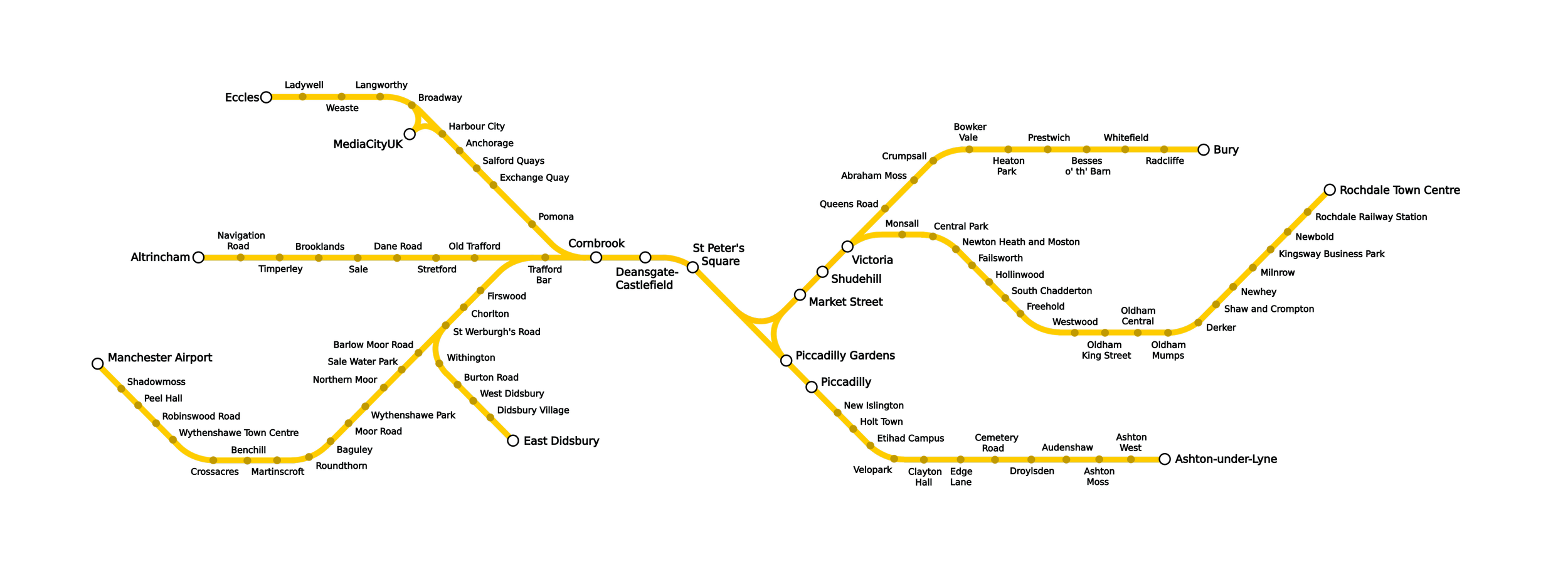
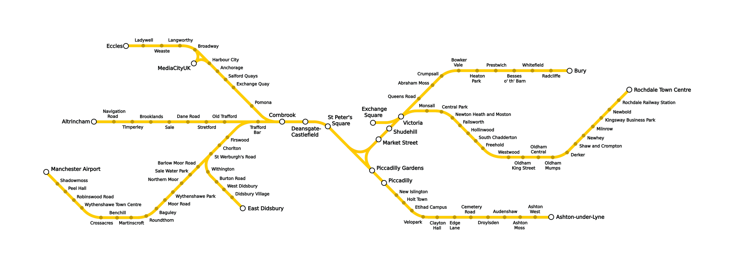
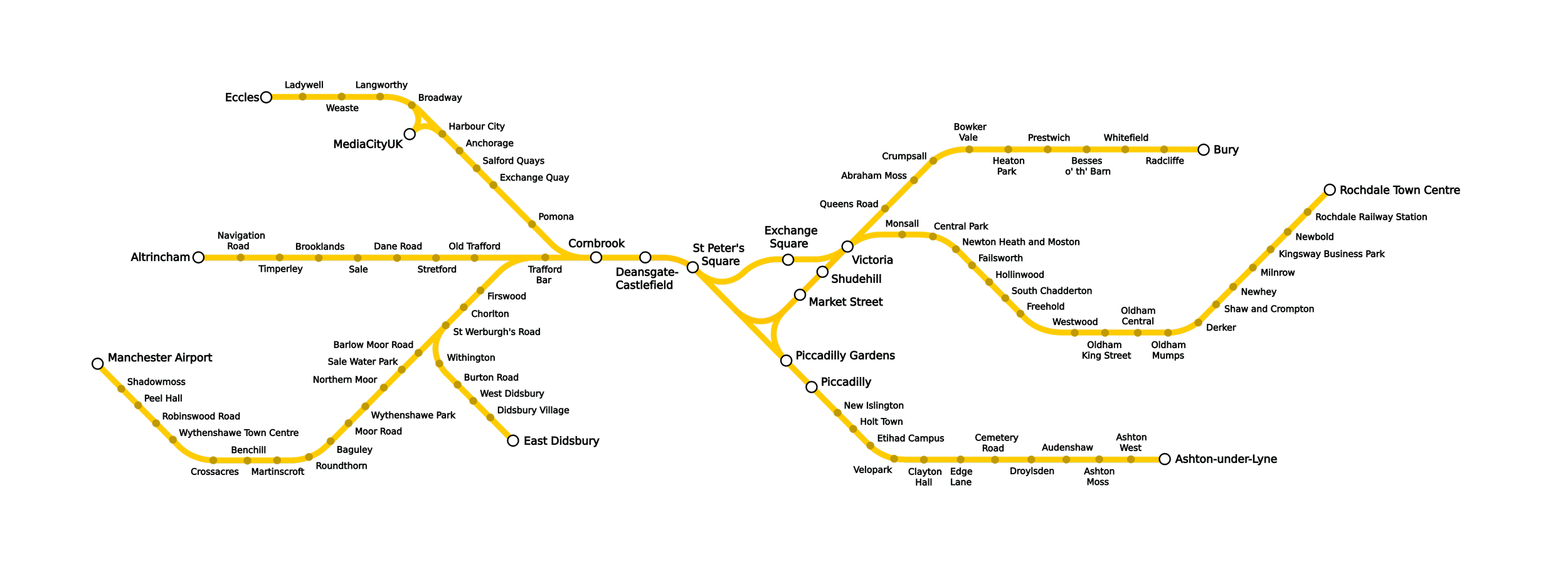
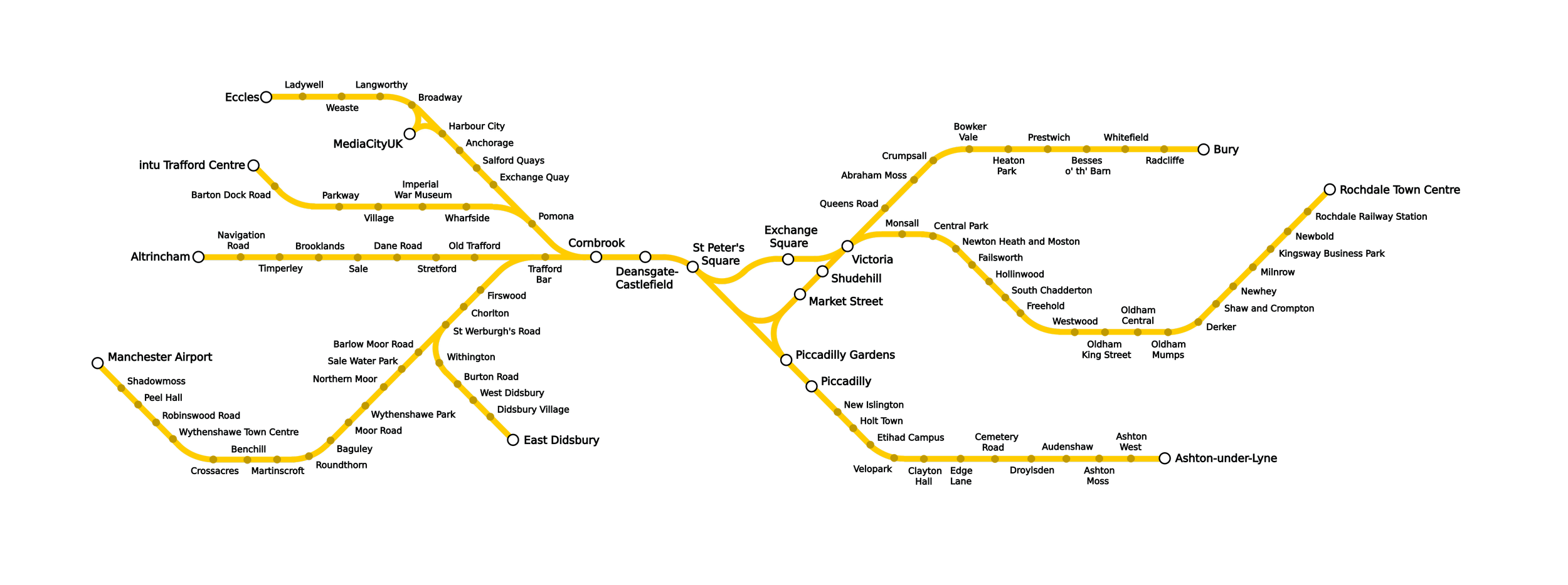
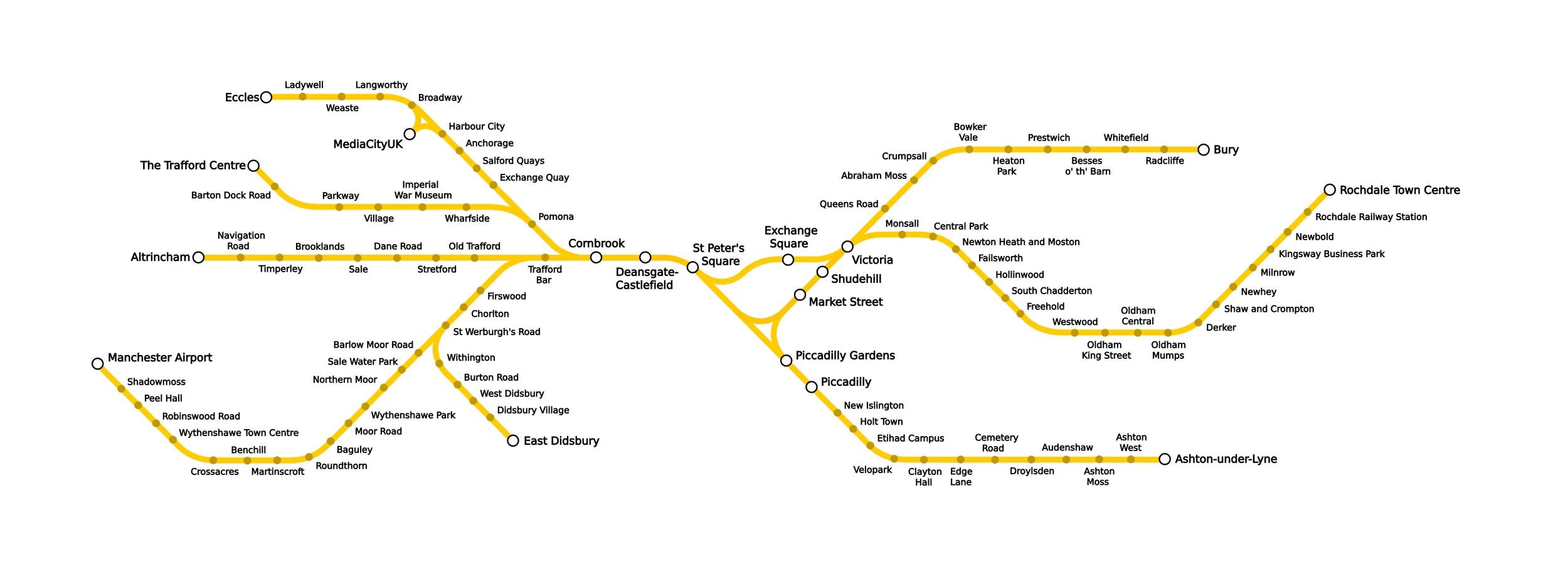
27 diagrams I put together showing how the Manchester Metrolink has expanded since 1992. Hover over the diagrams to view information about every extension.
All maps/diagrams © TramographyMCR and licensed for reuse under CC BY-SA 4.0.